Photo Credit: Scott Karduck
Field Work
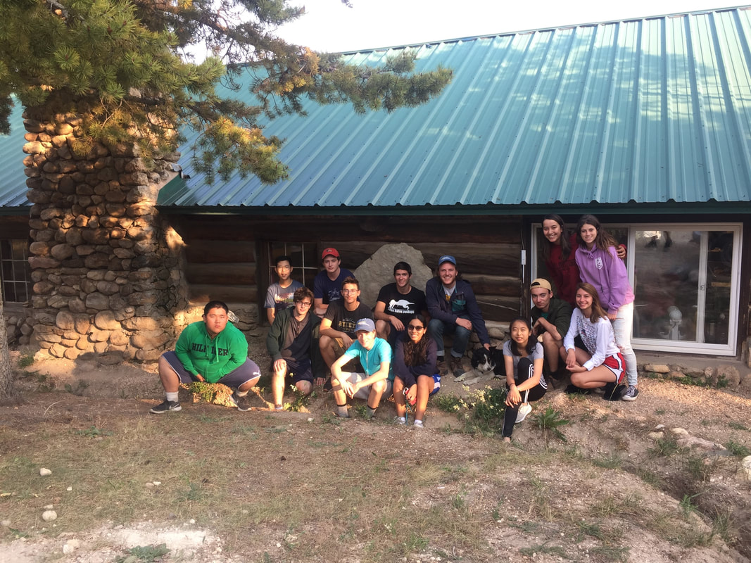
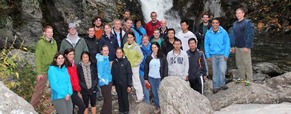
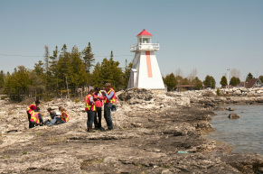
GeoDESLA 2018 - An introduction to the Geosciences - August 2018
|
One of the reasons students are attracted to an undergraduate degree in the geosciences is because of the fieldwork. We decided to give high school students the opportunity to experience this in order to help them decide whether a geosceinces was right for them. We did field work in:
- The Bighorn Basin, MT - Yellowstone National Park, WY - Red Lodge, MT More info on my teaching page |
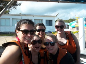
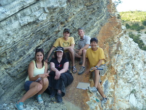
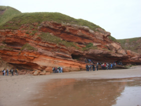
Drilling the PETM on the coastal plain - June 2016
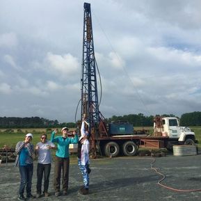
The Paleocene Eocene Thermal Maximum is a global warming event that occurred ~56 Ma which is thought to be one of the best analogues to modern climate change. The lab group that I worked with at Penn State worked on this time period and so I helped out with some drilling fieldwork that they conducted south of Cambridge, Maryland in June 2016. Alongside collaborators from the USGS in Reston, VA, we used a land based drill ring to core this interval. This new material will enable investigators to focus on coastal, rather than open ocean changes, which occurred during this interval.
Image: some of the amazing women I was working with on site. We washed and described the cores before packing them up to be stored at the USGS.
Image: some of the amazing women I was working with on site. We washed and described the cores before packing them up to be stored at the USGS.
Western Core Box Cruise, Scotia Sea - November - December 2015
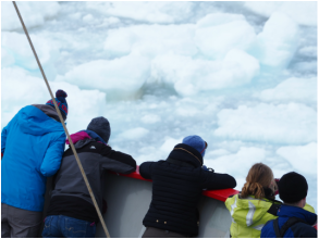
Some of the samples for my modern pteropod work come from the Southern Ocean. In November 2015 I was invited to join some of my colleagues from the British Antarctic Survey on a research cruise to South Georgia and the South Orkney Islands. On this cruise I collected pteropods for my research, and helped other researchers with their work which included krill surveys and copepod studies. More information can be found on my research page.
Image: Looking into the sea ice, Scotia Sea
Image: Looking into the sea ice, Scotia Sea
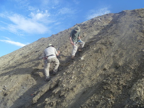
C-T Boundary fieldwork in the Kaiparowitz Plateau, Utah - July 2014
|
As part of my research, I went to the SW Utah to sample the Cenomanian-Turonian boundary. This field work involved trenching 30m of hillslope and collecting samples and collecting drill cores over the same time interval. More information can be found on my research page.
Image: Brad Sageman and Matt Jones work on the trench |
Quaternary History of the Grand Tetons, Wyoming - June 2014
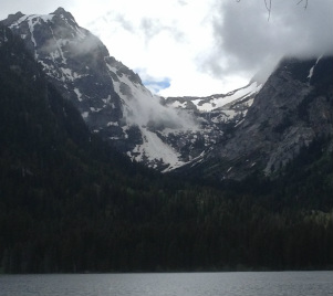
|
The third exercise of the Penn State field camp was to map an area in the Grand Tetons, Wyoming. As in the Elk Basin exercise, an emphasis was put on using both photogeologic and field mapping to ensure that the whole field area could be covered in the allotted time. One field day was spent at higher elevations mapping the moraines and glacial features. The second field day was spent down in the braided river studying the clasts in the current channel and in the abandoned river terraces.
Image: A U-shaped valley, a feature remnant of the last glaciation in the Grand Tetons, Wyoming |
Geologic mapping of the Elk Basin, Wyoming - June 2014
|
The second exercise of the Penn State field camp was to map the Elk Basin, Wyoming. This was a new mapping environment for me with lots of scree slopes, and excellent exposure. Another new factor was that we photogeologically mapped obvious geologic contacts on ArcScene before going into the field. These contacts were then verified during the day. This combination of photogeologic mapping and field mapping meant that a much larger area could be mapped in a shorter amount of time.
|
Sequence Stratigraphy of the Book Cliffs, Utah - June 2014
|
The first exercise of the Penn State Field School was an exercise in sequence stratigraphy. I was a TA and helped students as they made stratigraphic logs of four section in the Book Cliffs which were along a proximal to distal transect across the basin. Students then correlated parasequences across the four sections in order to make inferences about the geologic history. Although I was TA-ing, I still got the chance to brush up on my stratigraphic column and sequence stratigraphy skills!
Image: View from Kenilworth Canyon, Utah |
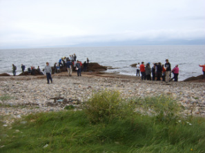
Biogeochemsitry and Reef Health in Discovery Bay, Jamaica - March 2013
|
As part of a marine biochemistry class at Penn state, we visited Discovery Bay Marine Labs in Jamaica to assess reef health. Our research involved snorkelling to identify species of coral, sponges and fish. We assessed reef health by looking for signs of bleaching and algal cover as well as total coral coverage. The research lab at Discovery Bay were focusing on two main projects: the lionfish project (more details on the outreach page), and a artificial coral growth project where they were inserting frames into the water in areas with no coral to encourage coral establishment. Analytical techniques used involved microfossil ID and alkalinity titration's.
|
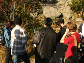
Acadian and Taconic Orogeny Transect, MA - NY, USA - October 2012
As part of our graduate orientation at Penn State, we made a transect across the Acadian and Taconic mountain belt from the autochthonous mollasse deposits to the allocthonous thrust sheets of the foreland, to the metamorphosed basement and cover rocks of the hinterland.
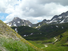
Umbria Region, Italy - July 2012
As part of the Urbino Summer School in Paleoclimatology, I visited field sites in the Umbria-Marche Basin in Northern Italy. We saw field examples of Oceanic Anoxic Event 1a (Selli) and 2 (Bonarelli), and the Paleocene-Eocene Thermal Maximum (PETM) at Contessa Road. We visited the K/T boundary Site at Gubbio. Finally, we went to Furlo to log a section which we later analysed for orbital cyclicity.
Lake Cadagno, Switzerland - June 2012
This was a field trip connected to the IsoPhos Conference. Lake Cadagno is a stratified lake which has a sulphidic groundwater input at the base. The bottom of the lake is therefore permanently anoxic. The surface waters are fed by surface water run off and are permanently oxygenated.
We visited the Piora Centre, a research lab in the Piora Valley by Lake Cadagno. They research the physical dynamic, chemistry and biology of the lake.
We visited the Piora Centre, a research lab in the Piora Valley by Lake Cadagno. They research the physical dynamic, chemistry and biology of the lake.
Cyprus – April 2011
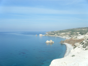
4th Year Field Trip
During this trip we studied the geology of Southern Cyprus. This ranged from the emplacement of the Troodos massif ophiolite and the sedimentary rocks associated with this, as well as the more recent sedimentary sequence which surrounds this. We studied articles prior to our trip and presented these in the field. On return we critically reviewed these articles using the field evidence we had collected for assessment.
During this trip we studied the geology of Southern Cyprus. This ranged from the emplacement of the Troodos massif ophiolite and the sedimentary rocks associated with this, as well as the more recent sedimentary sequence which surrounds this. We studied articles prior to our trip and presented these in the field. On return we critically reviewed these articles using the field evidence we had collected for assessment.
Whitefish Falls, ON, Canada – May 2010
3rd Year Field Trip
During this trip we were introduced to the overall geology of the area in the first few days. We then mapped a 1km x 1km area in pairs, using an aerial photo as a base map. At the end of the trip we made a geological map of our area and presented it, along with information on the background geology, for assessment.
During this trip we were introduced to the overall geology of the area in the first few days. We then mapped a 1km x 1km area in pairs, using an aerial photo as a base map. At the end of the trip we made a geological map of our area and presented it, along with information on the background geology, for assessment.
Monteregian Hills, Montreal, Canada - September 2009
3rd Year Igneous and Metamorphic Petrology Trip
During this trip we studied the metamorphic aureoles surrounding these intrusive igneous bodies in the moteregian hills. Samples were collected in the field and thin sections were prepared on our return. We then studied these thin sections and made estimates of the temperatures and pressures to which these rocks had been subjected.
During this trip we studied the metamorphic aureoles surrounding these intrusive igneous bodies in the moteregian hills. Samples were collected in the field and thin sections were prepared on our return. We then studied these thin sections and made estimates of the temperatures and pressures to which these rocks had been subjected.
Isle of Arran, Scotland – September 2008
2nd Year Field Trip
During the first half of the trip we travelled round the Isle of Arran to get an idea of the regional geology. This included studying the Devonian and Carboniferous sedimentary sequences and the younger intrusive rocks associated with these. We then spent 5 days mapping an area, in groups of four, using an ordinance survey map as a base map. At the end of the trip we had to create a geological map and a cross section, as well as a written summary on the geology of the area for assessment.
During the first half of the trip we travelled round the Isle of Arran to get an idea of the regional geology. This included studying the Devonian and Carboniferous sedimentary sequences and the younger intrusive rocks associated with these. We then spent 5 days mapping an area, in groups of four, using an ordinance survey map as a base map. At the end of the trip we had to create a geological map and a cross section, as well as a written summary on the geology of the area for assessment.
Pease Bay, Siccar Point and Arthurs Seat, Mid-Lothian, Scotland
1st Year Field Trips
These were our first field trips as geologists. We were taught how to note observations in a field book whilst looking at sedimentary, metamorphic and igneous features.
These were our first field trips as geologists. We were taught how to note observations in a field book whilst looking at sedimentary, metamorphic and igneous features.
